August 21 – Glengarriff to Killarney
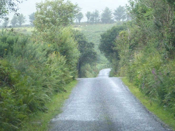
No pedal again today, so we decided to ramble instead. We hit the road under grey skies and motored through the little village of Glengarriff and the scenery continued to be spectacular, with the rugged hills and coastline on either side of us, then through rock tunnels in the hillside.


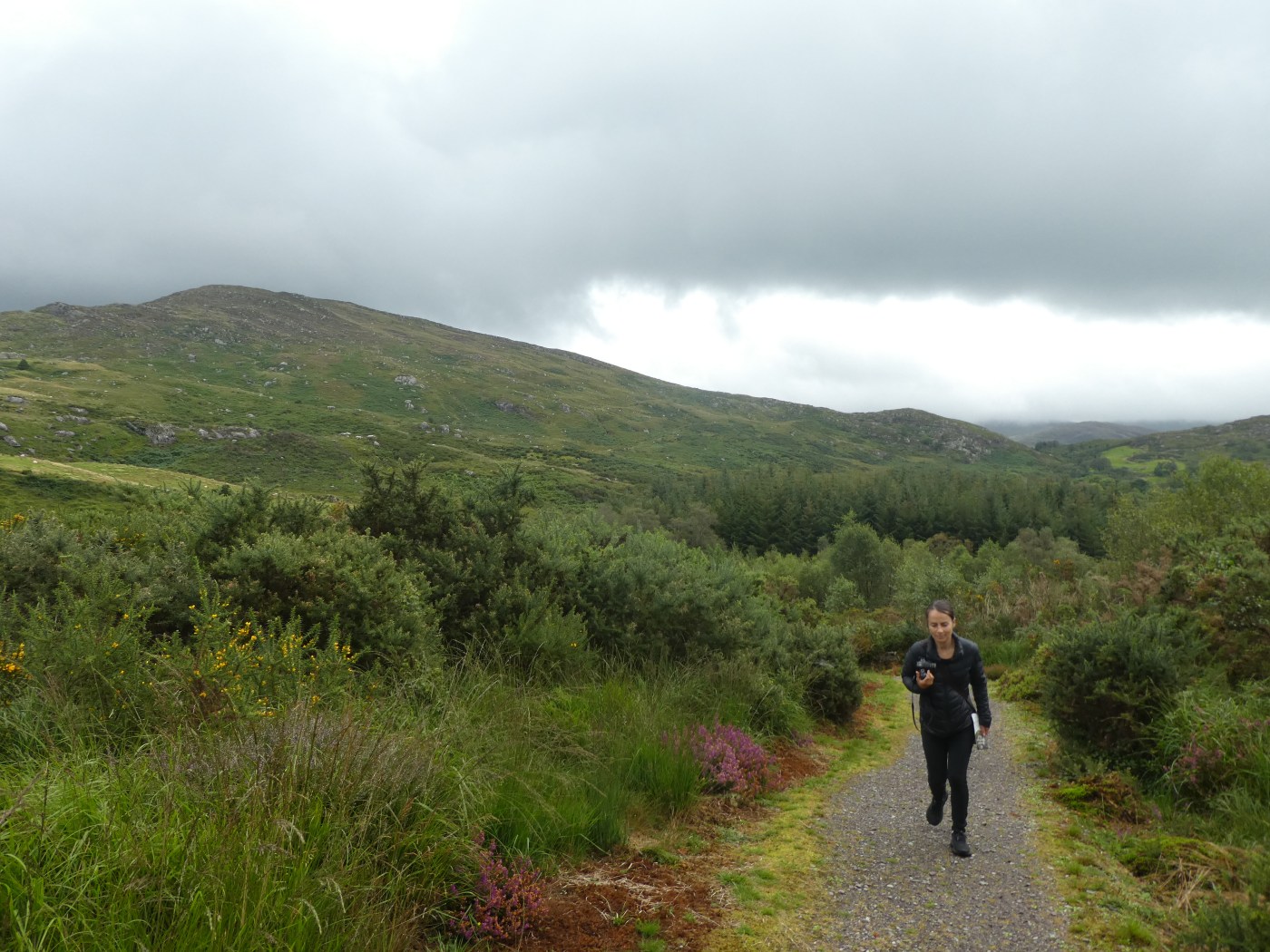
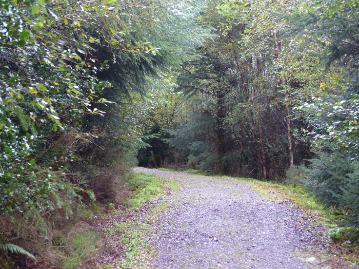
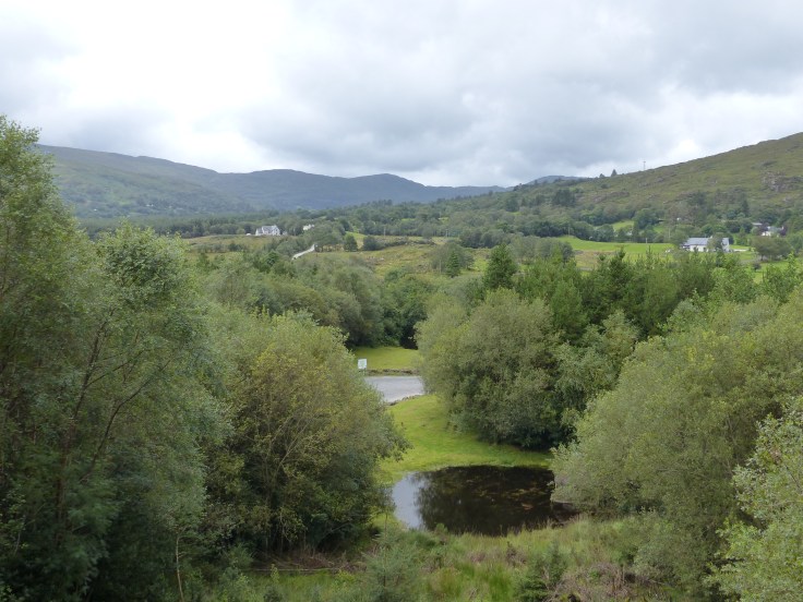
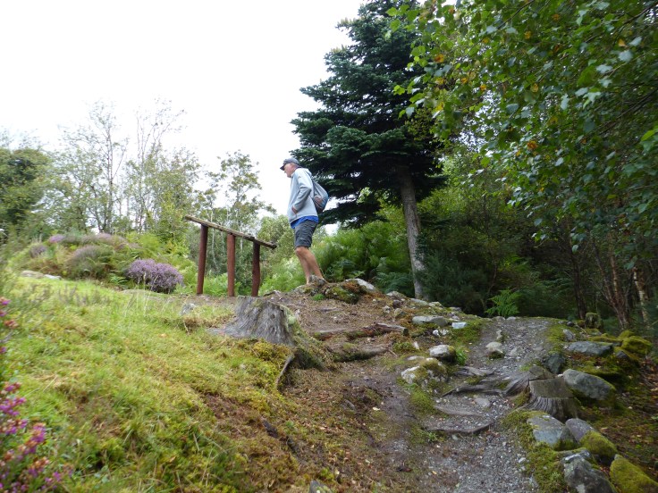
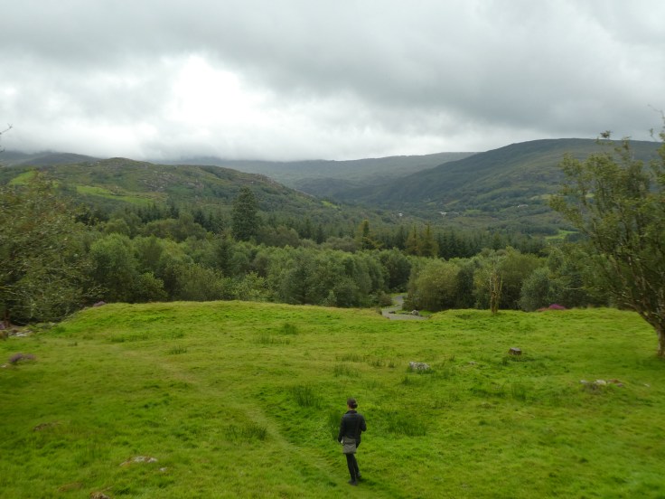
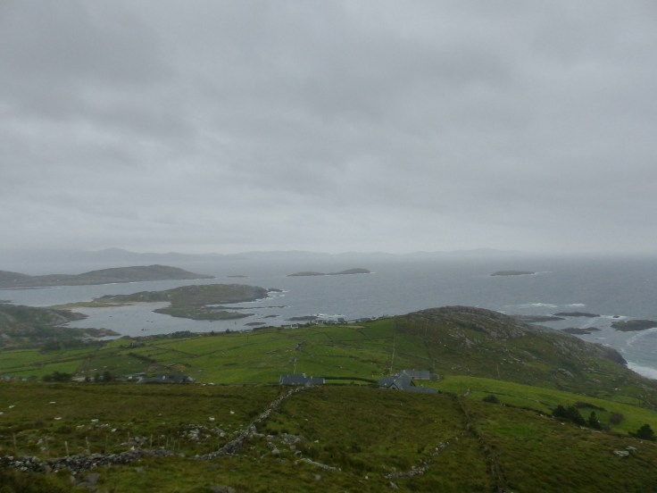
A short drive later and we stopped at the Bonane Heritage Park. This was another fabulous find, a park that’s been kept as natural as possible, with the bushland all around and nothing particularly developed. Arriving, all there is, is a small wooden hut with a ticket office, some brochures and an honesty box to pay the entry if the office was closed. The only facilities were a simple, single portaloo sitting on the side of a path, so it’s a park that’s really just bush and walking tracks, which was great. We popped our €10 into the honesty box and set off up the fairly steep trails, some of which were gravel paths and others just rocky tracks, to ramble through this historic site. Along the way we also had views down over the Bonane Valley.
Bonane Heritage Park has archaeological sites from the Stone, Bronze and Iron Ages and there’s a trail to walk around that takes you to each one. It’s considered one of the most significant archaeological sites in Ireland. It was great, to walk through the trees, along the tracks, no one else around, finding these ancient remains of the lives of people from hundreds and thousands of years ago. Come along on the ramble with me and I’ll take you to each of the sites and tell you a bit about each one, courtesy of the information signs along the way.
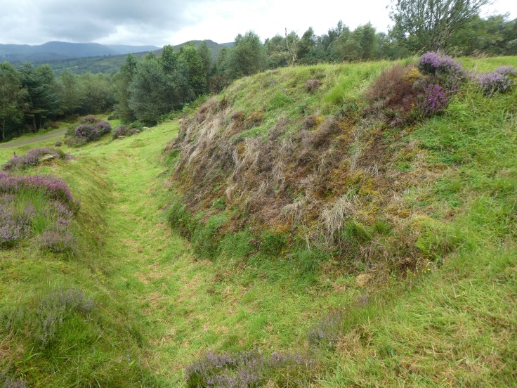
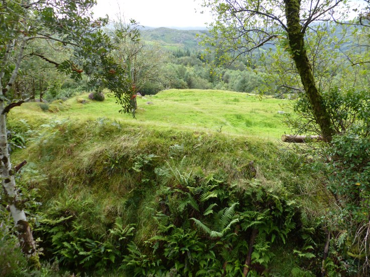
Up the hill we go, then off the gravel path and onto a rocky little track and we arrive at the Ringfort. This was once both a farmstead and a home and is a fortified construction that’s over 2000 years old. This particular Ringfort is one of the largest in Ireland. This is what amazes me about archaeologists who discover sites like this. Someone walked here one day, saw something that essentially just looks like a grass bank and some stones and said, “I know what this is, it’s a two thousand year old Ringfort!” That’s what separates the ignorant casual sightseer like myself, from the expert archaeologists…they know what they’re looking at! Archaeologists think the circular design was intended for defensive purposes and there would have been dwellings inside, arranged in a triangle, offering more protection, because when you stood in one dwelling, you could also see the other two. From its position and its view, it’s thought to have once been home to a chieftain or some other important member of the community. The Ringfort is surrounded by a deep perimeter ditch and double earth embankment, known as a ‘Foss’.


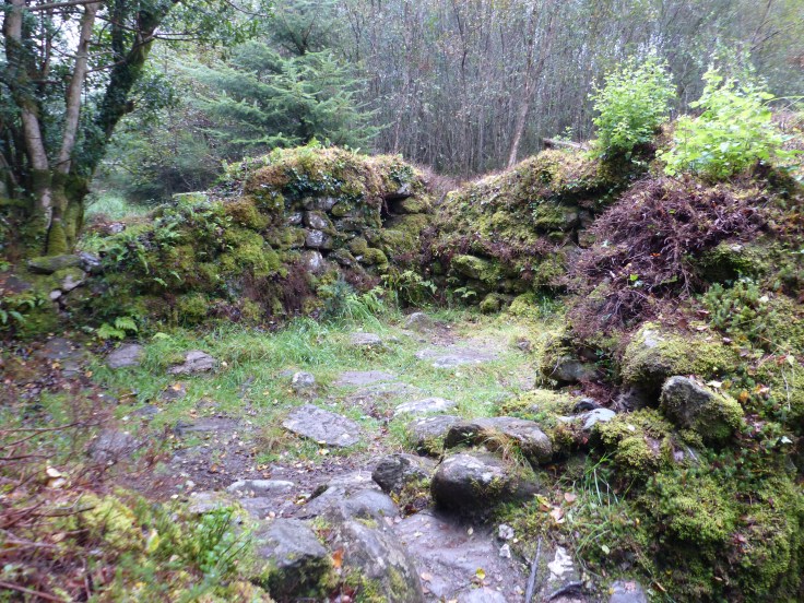
We’ll go carefully down the rocky track and then up another gravel path and tucked away into the trees is the Famine Ruin. This small stone house consisted of just one room. The roof would have most likely been thatched and an open fire would have been used for cooking and heating. During the winter, animals would have been brought into the cottage too, for warmth. The last recorded occupant of this particular Famine Ruin is Maureen O’Shea. She raised six children in this tiny cottage, but the family were scattered during the famine, with two sons and three daughters emigrating to America in search of a better life. One son remained in Ireland. What a life it must have been, in that tiny little house, in the freezing winters, with just a small open fire for warmth, with little tackers and animals sharing the cramped space. A harsh life indeed.

Now up we go again, climbing up another gravel hill and we arrive at the Stone Circle. This is thought to have been built in the Neolithic / Bronze Age, between 3000-2000 BC. In this one, the stones are arranged in a specific way, to act as an astronomical calendar. If you look at the photo, the stone on the right is the Recumbent Stone, the one in the centre is the Centre Stone, also known as a Bolder Burial and the two on the far side are the Entrance Stones. These form a line and on the summer solstice on June 21, the longest day of the year, the rising sun aligns perfectly at 6:40 am to shine through the two entrance stones. Other similar alignments of the different stones mark moonrise positions and an Equinox sunset. This Stone Circle has eight Lunar and Solar Alignments. Pretty darn clever I reckon!
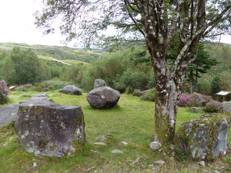
Just along the path from the Stone Circle is the Fulacht Fiadh, or cooking pit, which dates from the Bronze Age. The stones mark out where the pit once was, so you can see the depression in the ground. The Fulacht Fiadh was a pit filled with water, that was heated to boiling by putting heated stones into it. Meat such as venison, rabbit or pheasant was then wrapped in straw and placed in the simmering water, where it would be left to slowly cook. Once again…very clever and quite ingenious I thought, almost like an ancient crock pot! I did wonder how long it would take water to boil though, just by putting hot rocks into it. Patience was surely an essential character trait of the cook and the hungry folks waiting!

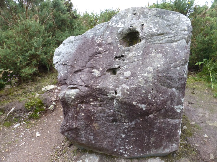
Up another track, around a corner and just off the path is what looks like a boulder, with a hole in the front of it. This is a Bullaun Stone, which is basically just a flat topped rock with a ‘bullaun’ or basin carved out of it. This one is considered quite unusual because instead of lying flat with the basin in the top, it’s standing upright with the hole in the front. The original purpose of these stones is unclear, but it’s thought they may have been used to gather rain water, or used to grind corn or grain, as well as being ceremonial and used in rituals.
Down the hill we go and up another short track and we find a Standing Stone. There are a lot of Standing Stones in Ireland (in fact we saw more of them today as we drove on, once we knew what we were looking at). They usually date from the late Bronze Age to the Early Iron Age and are thought to be both ceremonial and practical as a marker for a meeting place.

That was our ramble, in a quite special place, walking along the paths and tracks and learning something of lives from Ages past. It was even better that it felt authentic, because there was nothing particularly developed in the Park, just the paths and tracks to follow. It was nice that it had been left as a simple walk through a natural environment, with ancient, historic remains in place and not much else. That definitely made the visit and the experience even more top notch.
On we went and arrived in Kenmare and this little town was absolutely bursting at the seams. There were people and tour buses and cars seemingly taking up every available inch of space on road or path. We called into the local supermarket to pick up some elevenses for the road and once again, I heard Gaelic in conversation. Yesterday, when we were in Bantry, I heard snippets of conversation as people passed us in the street, with Gaelic as the language. Then I saw a mum and son, who looked to be about seven years old, in conversation with each other, speaking Gaelic. Today, catching pieces of conversation from the people around us at the supermarket, I heard it again. It’s just lovely to hear the language spoken and obviously still in common use, even with kids. A traditional language kept alive, which is just wonderful.
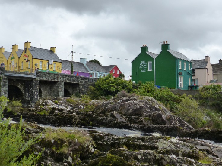
We continued on, following the Wild Atlantic Way again and we passed through the little town of Sneem. Apart from having one of the best names a town could have, it was another lovely little place, with those pretty painted buildings and an air of time having not passed. Before we made it to Sneem the rain had started to come down and it hadn’t let up, in fact it was partying even harder, so our plan to sit somewhere for elevenses was somewhat curtailed. Our sitting spot became the confines of the van. But, that’s one of the advantages of having that option I guess. So we sat in Sneem, in a car park, having elevenses in the van. It might not have been one of our more memorable locations, but at least we were dry.

The rain eased a little so we set off for a walk around the town. One of the first things we saw really did set the tone of the town. There was an older man sitting on a stone wall in the centre of town and sitting on the ground beside him, on a lead, was a white long horned goat. Yep, you read that right, a long horned goat. I said hello and he said hello and it was if it was the most natural thing in the world to bring your goat to town on a lead and sit there, watching the world go by while that goat had a doze beside you. That, right there, is charm. We strolled along the street, passed those lovely little traditional shops and over a bridge with water gushing over rocks below.


As we made our way back, the rain really started to bucket down, so we picked up the pace and made our way back to our motorised shelter. On the way, we passed the man and his goat again. They were still there, on the stone wall. This time the goat was standing on the wall beside the man and they were face to face, foreheads touching, with the man giving the goat a scratch under the chin and the goat standing there, leaning on the man, with its eyes contentedly closed. Both seemed to be oblivious to the rain.

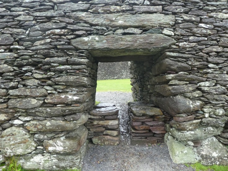
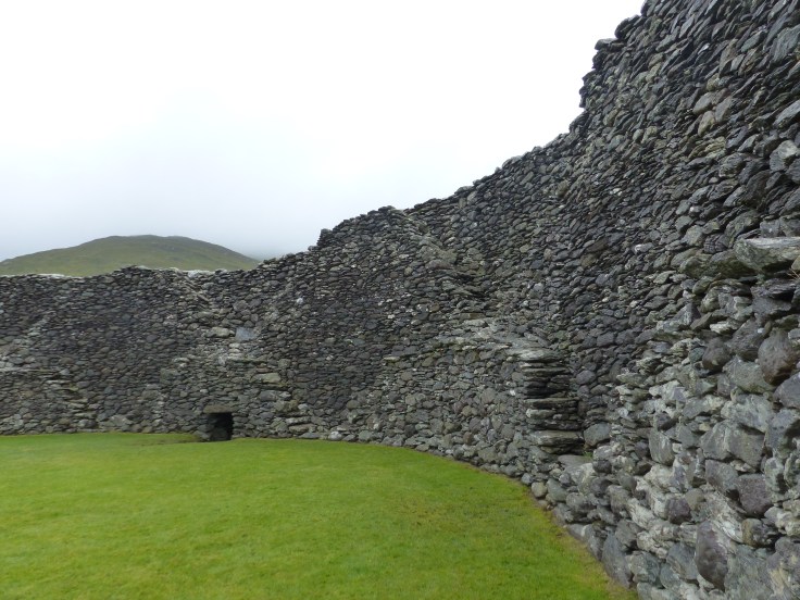
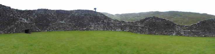
Off we went, cruising along, with more spectacular scenery and then we turned off the main road to have a look at Staigue Fort. This took a bit of effort to get to, because it was up a very narrow, single track road and in the van, that took some manoeuvring when there was an oncoming car. We squeezed ourselves into the hedge on the side of the road, or hoped the car would pull into a passing bay to let us past and we gradually made our way up the hills and around the corners to arrive at the fort.
This was another amazing piece of ancient Irish history and just seeing it from a distance was pretty special, before we even walked up to it and inside its walls. This fort is one of the largest in Ireland and is thought to have been owned by a chieftain or wealthy landowner who needed the security. It’s built entirely without mortar and would have been home to the chieftain’s family, guards and servants and would have been full of houses, outbuildings and probably tents.

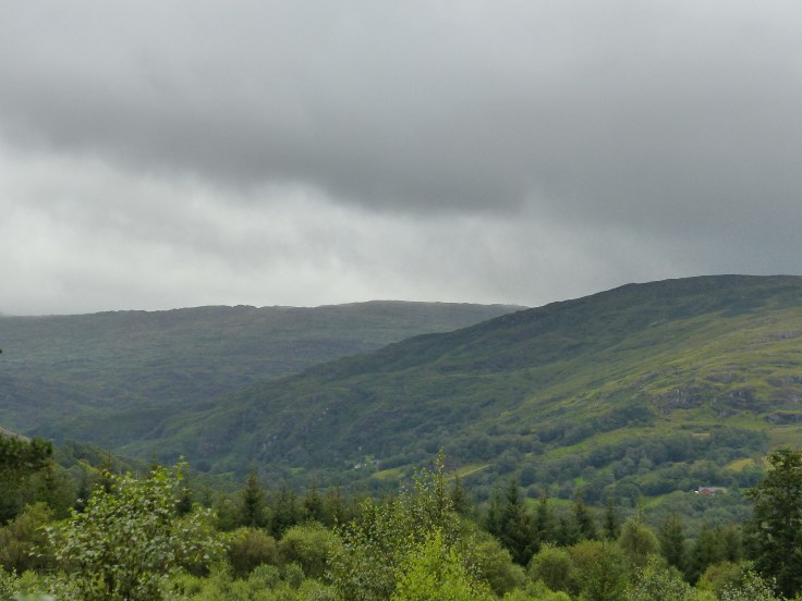
On we went, passing through Caherdaniel and then had some of the most spectacular views we’ve had so far. The coastline was amazing, with cliffs, ragged rock faces, inlets and crashing waves and on our other side, the vast expanse of hills and imposing mountains and every now and again a house dotted on the hillside.


Then it became pretty hard to see anything at all. The clouds came down. The rain came down. The fog came down and it was a grey and white landscape viewed through the sideways rain. It absolutely bucketed down, horizontal driving rain and clouds of mist. It was actually perfect weather for the wild and woolly landscape that we were in and gave everything an atmosphere that was somehow just right.
We arrived in Killarney, found a place to stay, got some laundry done and called it a day. I loved the places we were able to visit today. It was quite special being able to walk in the footsteps of past lives, seeing the remains of those lives so clearly in front of us. It gave us a glimpse into the ancient past, in a country steeped in history. It also made me think of our own history and so much that we can do better. We have the oldest continuous civilisation, in our own First Australians, with a 60,000 year history, yet there doesn’t seem to be the same level of respect or preservation of our own ancient past. It was a day for learning but also a day for reflecting on yet another thing we can learn from. Our travels through Ireland continue to give us something to wonder at, think about and learn from each day and getting to do that in some spectacular settings with breathtaking scenery is a rich bonus indeed. More drops in the bucket of gratitude that already runneth over!

Wow the rock tunnels are amazing!! What a gorgeous place u visited today 🙂
LikeLike
Yep, going through the arches was pretty speccy and the ruins and the heritage park we’re brilliant
LikeLike